Crédito: fuente
A «flash freeze» could accompany this storm as temperatures drop rapidly below freezing, making for very dangerous conditions.
A flash freeze happens when rapidly falling temperatures «quickly turn any wet or slushy roads to ice,» the National Weather Service office in Des Moines, Iowa, noted, warning it will likely create significant travel problems Thursday across the Hawkeye State.
The arctic chill won’t spare the rest of the country either. By Monday morning, 212 million Americans — roughly 67% of the country — will experience temperatures below freezing. This includes every state in the Lower 48.
The cold trend, which will affect states as far south as Louisiana, will continue for the next 10 days.
Blizzard sets the stage for extreme cold
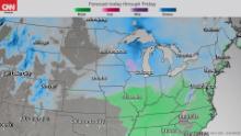
Strong winds, blowing snow and rapidly falling temperatures are expected Thursday and Friday from Nebraska to Michigan as over 35 million people are under winter weather alerts.
Blizzard warnings are in place across central and northern Iowa through Friday morning, while winter storm warnings and advisories stretch farther east to Chicago and Detroit.
The criteria for blizzard conditions do not necessarily require snow to be falling. The technical definition requires sustained winds of at least 35 mph and poor visibility, frequently to less than one quarter of a mile (this could be caused by falling and/or blowing snow). Both requirements must last for at least three hours.
As with this storm, only moderate accumulations are forecast, ranging from 2 to 5 inches in Des Moines and up to 8 inches in Green Bay, Wisconsin. Higher totals can be expected downwind from Lake Michigan in favored lake-effect areas, where up to a foot of snow is possible.
Ahead of the system, a wintry mix of rain and snow is forecast as temperatures briefly surge before dramatically falling behind the cold front.
Winds are forecast to gust over 45 mph, blowing snow and reducing visibilities under a quarter mile across parts of Iowa. As the mercury drops and the snow begins to drift over roadways, conditions will deteriorate at a moment’s notice.
Waterloo, Mason City and Fort Dodge are all predicted to experience «extreme» travel impacts from this potent storm, according to the NWS hazards matrix.
Still, high snow totals won’t be the biggest threat from this storm. The real showstopper will be the cold air settling in early next week.
A flash freeze is on the way
The coldest air will start diving on Saturday south through the upper Midwest and Great Lakes. Places in central Wisconsin could see temperatures plummet to minus 25 degrees on Sunday morning, with high temperatures struggling to make it to zero. Overnight lows could be cold enough for car antifreeze to solidify.
«We get two to three of these cold snaps every year,» said meteorologist Marcia Cronce from the National Weather Service Office in Milwaukee. «We are heading into the coldest air of the season, it will feel jolting.»
Schools in St. Paul, Minnesota, cancel classes if the 6 a.m. forecast for the following day is minus 25 or wind chills are forecast to drop to below 35.
Another concern is how the bitter cold air will affect the flow of water and traffic on the major rivers in the Midwest.
«Areas to our south — the lower portions of the upper Mississippi and the Illinois River — are seeing relatively decent flows and levels are good for navigation, especially around St. Louis, but extreme cold outbreaks give us a concern for ice bites, which takes flow out of the river,» said Justin Palmer, a hydrologist with the North Central River Forecast Center in Chanhassen, Minnesota.
«Ice gets created in the pools, we drop a lot of flow, which drops stages and becomes an issue for potential groundings. On the Illinois River, however, with this extreme push of cold air we could potentially see some ice form, but overall were seeing good traffic in St. Louis and believe this year the rivers have been more open with this warmer year.»
It’s not just the Midwest that will be seeing this deep freeze. Southern states like Texas, Louisiana and Mississippi will be 15 to 30 degrees below normal Tuesday and Wednesday.
The polar vortex is coming
This will cause the polar vortex to weaken even further, making for bitterly cold conditions.


